RHS program first in state
The Russellville High School Junior ROTC program recently completed their semester of partnership with the University of North Alabama in a Geographic Information System (GIS) program.
Seven students in the program learned skills involving global positioning system (GPS) tools and detailed mapping through the ArcMap software.
The students participated in accurately locating and mapping natural gas valves in the downtown Russellville, Ala. area.
Norman Lier, a sponsor for the group, said going forward he hopes to create a benefit for the community as well as help students develop their skills with GIS.
“We are only limited by our imaginations for this program,” Lier said.
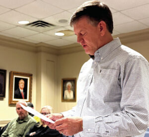
The students presented what they completed and learned over the semester to members of the city council and school board Dec. 9.
Russellville High School student Niles Butts said the partnership with UNA has opened his eyes to what is available.
“The first part of the semester was where we focused on basics of geography like landforms,” Butts said. “And then we started getting into the GIS skills and started working on mapping the gas valves downtown. All of this has gotten me thinking more geographical.”
Dr. Lisa Keys-Mathews, a Professor of Geography at UNA, said this was the only class like it in the state and probably in the region. A chance meeting with city council member, David Palmer, led to the program being created at Russellville High School.
“In 2012 I was at a conference for the ESRI software and I met and talked with David Palmer,” she said. “We had seen a similar presentation and we had the same thought about starting a program here at the high school.
“Students that participate are also getting college credit,” she said. “They are getting credit for a general education class through the Geography 102 course.”
Keys-Mathews said the students have been great and shown a lot of promise.
“The students have been able to work with a lot of the tools that they will be introduced to at the college level including some versions of the software,” she said. “Hopefully we can introduce more high-level software in the future. But this being the first class of its kind in the state and in the region is very exciting.”
The partnership between UNA, the Russellville City School System and the Franklin County GIS Consortium has been behind bringing the program to the students. Councilmember Palmer has been a large part of bringing the program to the school and he said he sees many benefits of the program.
“Not only are the students able to discover and polish some of these skills involving GIS, but they have already provided a great benefit to the city of Russellville,” Palmer said. “Going forward, anything we can add to this program and anything else we can bring to the kids will be a benefit to the entire community.”
During the presentation, Butts said that he would like to see the future of the program include more details in the actual mapping process.
“In the future I would like to see more layers on the map, more layers of information,” Butts said. “Right now we just have the location of the valves mapped, but I would like to see that continue forward and maybe be able to map the gas lines as a whole.”
Group member Cameron DeArman said during his time in the program he learned just how important geography is.
“We use geography everyday,” DeArman said. “We use it in just about everything we do on a daily basis.”


